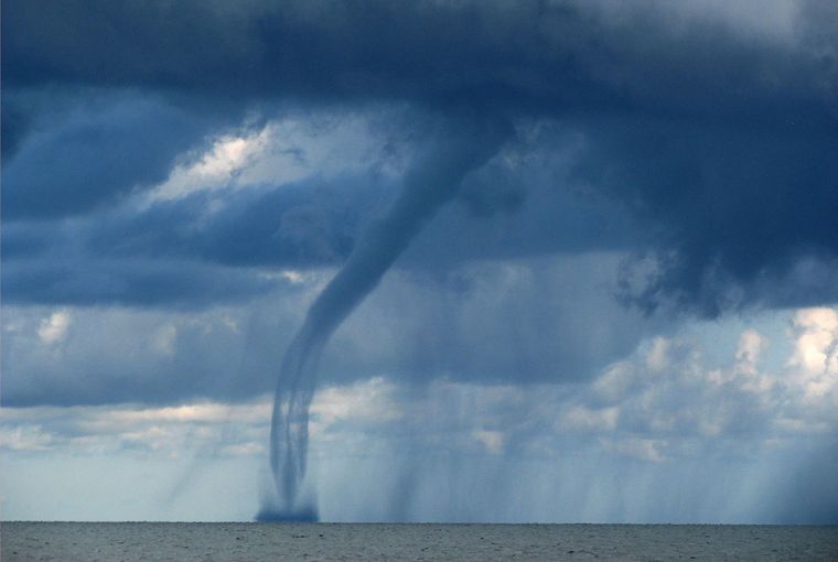
New research says reports of waterspouts, a whirling column of air and water mist that usually appears as a funnel-shaped cloud, are increasing every year.
A record 232 were reported the week of Sept. 28 to Oct. 4, 2020 – almost triple the previous record.
Asked about the increase, Wade Szilagyi, a director of the International Centre for Waterspout Research, says, “It’s too early to say it’s climate change or if it’s more an artifact of technology where there are websites to report waterspouts and everyone has a cellphone to take a photo.”
Where they happen
Non-tornadic waterspouts are most common. They only occur on larger bodies of water such as the Great Lakes, tending to be closer to shore where water is warmest, and the land breezes necessary for them to set up occur.
Tornadic waterspouts, the second kind, are associated with a tornado moving over water and occur on inland lakes as well. They are more dangerous with winds of 130 to 150 km/h.
Non-tornadic waterspouts don’t move much and are most common in late summer and early fall due to warm lake temperatures and cooler air temperatures. Ideal conditions for waterspouts are days with calm offshore winds to allow mixing of the air. They occur on the lower Great Lakes but are most common on Lake Erie as it is the warmest.
Environment and Climate Change Canada (ECCC) Meteorologist Geoff Coulson says boaters should stay away from any type of waterspout.

Leave A Comment