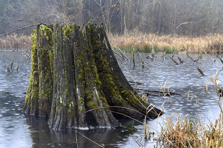
A cold, wet spring with water-saturated snow and high levels of precipitation has caused serious flooding in Ontario. Properties, water safety, fish, wildlife, and recreational opportunities have all been affected.
Major flooding took place in eastern Ontario, along the Ottawa River, and in the Rideau and Mississippi Valley watersheds, in Essex County in the southwest, and in Muskoka in central Ontario.
In some areas, navigation has been closed to boaters, and it remains to be seen what, if any, impacts the flooding will have on fish spawning.
Havoc in Ottawa area
Brian Stratton, Manager of Engineering Services for the Rideau Valley Conservation Authority (RVCA) said this year’s flooding was worse than in 2017, the worst year previous.
Flows reached 6,000 cubic metres per second, 50% worse than in a high-water year, he said. A state of emergency was declared in Ottawa in late April. Hardest hit were Constance Bay, Cumberland, and Britannia Bay on the east end of Ottawa.
The RVCA covers the Rideau River Valley watershed, which drains more than 4,000 square kilometres of eastern Ontario and flows, for the most part, towards the Ottawa River. About 620,000 people live in the watershed including part of the City of Ottawa.
The first flood warning was issued on April 19. Waters have stabilized, but the flood warning is still in effect. Stratton believes waters will remain high into June.
No fishing
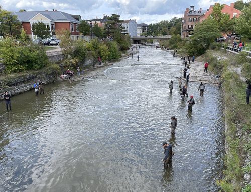
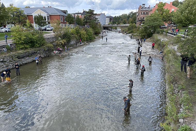
On May 14, Minister of Transportation Marc Garneau expanded areas where navigation is prohibited due to flooding. In Ontario, that includes the Ottawa River between the Otto Holden Dam (near Mattawa) and the Deux Montagnes Lake (near Hudson, Quebec) and the Mattawa River, between Hurdman Dam and confluence of Mattawa River and Ottawa River. Pleasure craft and human-powered craft, such as canoes or kayaks fall under the prohibition, which means angling opportunities in these areas are off limits.
Effects on fish unknown
Jennifer Lamoureux, RVCA aquatic and fish habitat biologist, said fish spawning success in flood conditions will vary based on the species, the river or lake system, and the quality of habitat needed to spawn.
“It’s complicated,” she said.
She said flood-related changes in water temperature, water quality, levels, velocities, food supplies, as well as habitat conditions and requirements could all affect spawning efforts.
She said northern pike might benefit due to more available spawning habitat and water levels that support the development of their young, provided water levels do not recede too quickly.
Walleye and suckers in systems most affected by flood levels and high flows could be adversely affected, since flow water levels might make spawning difficult.
Mississippi Valley not spared
Flooding also hit record levels in the Mississippi Valley Conservation Authority (MVCA) watershed, which covers the Mississippi River from Mazinaw Lake to Ottawa, and the Carp River watershed. MVCA issued its first flood outlook advisory on March 4 and first flood warning in April. Weeks later, many waterfront property owners are still dealing with flood damage.
Community Relations Coordinator Shannon Gutoskie said, “It was a record year throughout the watershed, and rivaled or exceeded levels set in 1998.” She also cautioned, “Since flows and levels remain higher than normal in many areas, anglers (boaters) should exercise caution as new hazards may exist on the waterways that are not currently visible given the high water.”
Southwestern sees six storm events
Essex County in southwestern Ontario also experienced flooding in the Leamington area, on the lakeshore, as a result of high Lake Erie levels and storm events. The flooding also caused a temporary closure of creeks in the area, damage to roads and shoreline properties, as well as erosion.
Essex Region Conservation Authority Director of Communications Danielle Stuebing said, “(As of mid-May) we have had six storm events in one season, which is very concerning.”
Muskoka gets reprieve
Muskoka District flooding subsided in mid-May, but municipalities in the District were under a State of Emergency from April 28 to May 13.
Transport Canada restricted navigation on the Moon River, Lake Muskoka, and the north and south branches of the Muskoka River, ending on May 15. Some roads accessing waterways and waterfront cottages and homes were also impassible at times and property damage and drinking water quality issues arose, too.
“Lake Muskoka is still high, but is expected to return to the normal operating zone in the next couple of days. Lake Rosseau and Lake Joseph remain high, but water levels are slowly decreasing. The majority of lakes and rivers within the watershed experienced some impacts from the high water levels and river flows this spring,” said Ministry of Natural Resources and Forestry (MNRF) Assistant Media Relations Officer Nicole Michalchuk.
“The more natural the shoreline, the more resilient it is to the effects of high water. While it is difficult to measure how fish spawning may be affected at this stage, we do not anticipate any long-term effects, as local native fish species are adapted to high water levels and flows in the spring.”
She added the MNRF is creating an internal task force to consult with municipal and industry leaders as well as Indigenous people to discuss how to better prepare for future floods and reduce impacts when they happen.

Leave A Comment