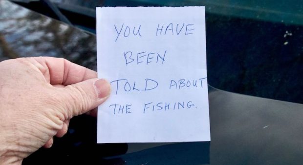
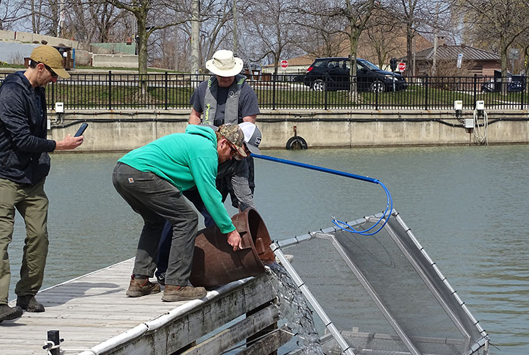
I saw the note left under my wiper blade after I started my truck to leave. I had been fishing a small lake which, while ringed by private property, was accessible through a narrow road allowance. My few hours of fishing included an unpleasant conversation with a cottager who told me I was trespassing.
He backed off when I told him I knew about the road allowance, but it still took a lot of fun out of the day. The note on the windshield reading, “You were told about the fishing” also felt vaguely threatening.
I didn’t know it at the time, but Conservation Officer Tyler Cameron of the Northern Development, Mines, Natural Resources, and Forestry (NDMNRF) ministry later told me, “It is an offence to interfere with someone lawfully hunting, fishing, or trapping. COs not only help protect the rights of landowners, but the privileges of people hunting and fishing.” To protect your own right to legally hunt or fish, you must know you are on public land.
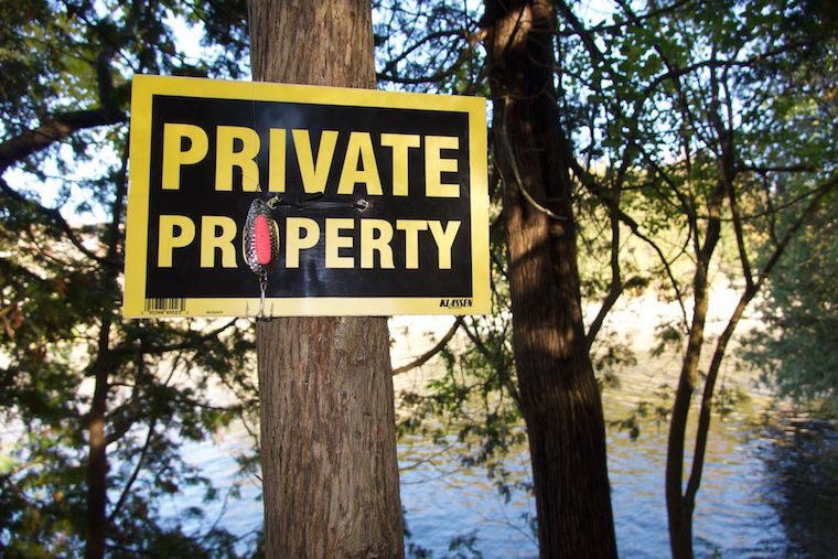
In southern Ontario, if you think you are on private property, you probably are. And you need to have permission to be there. On the other hand, Crown land in northern Ontario is easily accessible by old logging and mining roads, but it is still incumbent on the angler or hunter to confirm that they are on public property.
Info readily available
This is not as easy as you might expect in the information age. The most convenient way is to check the online Crown Land Use Policy Atlas (CLUPA) found here. By searching a known address or simply clicking a location on the map, users can access a wealth of information about locations in Ontario.
The atlas identifies private and public land. And if it is indeed Crown land, provides details about what activities are allowed there. You can determine if hunting and fishing are acceptable, but also if snowmobiles can be used or if camping is permitted.
As impressive as the system is, it struggles on mobile devices. So you are wise to do your surfing before going afield. It also has a glaring issue with conservation authority properties. Any I checked near Port Hope and Thunder Bay came up as private properties.
What to do
Another option is the Ontario government’s Make a Topographic Map portal. Here, users can overlay topographic and aerial imagery to get the lay of the land anywhere in the province. Lot lines are visible when the “Assessment Parcel” layer is on, indicating private property.
At the municipal level, cities also put detailed maps online. Kawartha Lakes for example, has a map of city boat launches and you get details about location, docking, and availability of parking. Additionally, the planning department has posted highly scalable maps showing lot lines.
Selecting a parcel brings up the legal description, but it’s more interesting when no information comes up. That indicates the land may not be privately owned. A follow-up with the local planning department will let you know.
Resources such as these don’t create public land, unfortunately. And if you want to access privately – owned land, there is no substitute for simply talking to a landowner and asking to use their land. More often than not during my experience, after a respectful conversation with the owner, I’ve been allowed on their property, strengthening angler/hunter/landowner relationships in the process.
Originally published in the May 2022 issue of Ontario OUT of DOORS
Respectfully, the issue with the Crown Land Use Policy atlas and the conservation authority properties is most likely that from the point of view of the Crown they are private land because they are NOT Crown land. Strictly speaking, Crown Land (“Public Land”) in Ontario is only land owned by the Crown – the Province of Ontario. Other properties, including conservation authority properties and municipally-owned forests, are considered private land by the Crown even though in many (most) cases they are accessible to the public – but definitely check the rules and regulations for each property before accessing it as they differ widely in my experience.