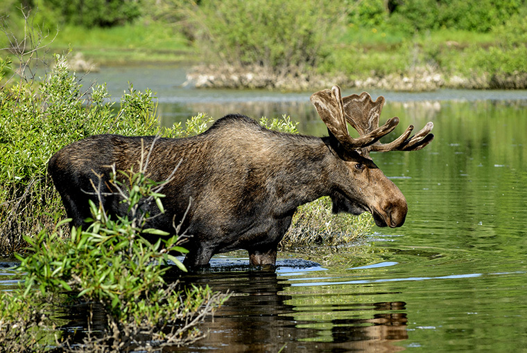
After a dismal moose survey season in the winter of 2023-2024, the Ministry of Natural Resources (MNR) completed an impressive list of surveys this season, gathering important data that informs population status and hunting opportunities.
Due to poor survey conditions last year, the MNR completed surveys in only five Wildlife Management Units (WMUs). Conditions for counting moose were much more favourable this winter — not only did the MNR address the backlog from last year, but they were also able to complete all the surveys they had planned for this year.
Surveys require organization
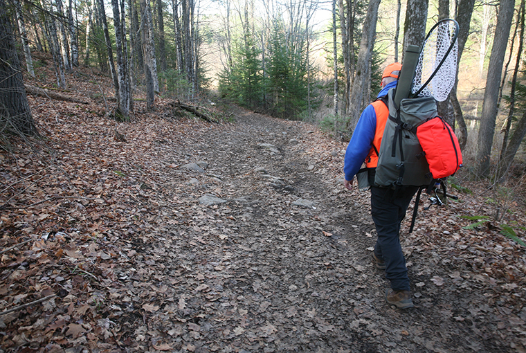
A survey effort of this magnitude requires a small army of personnel, a combination of government and commercial helicopters, and the right weather conditions. Between Dec.17, 2024, and Feb.14, 2025, the MNR successfully surveyed 29 WMUs. The MNR flew 600 plots and logged more than 750 hours of flight time. At peak, 12 helicopters were in the air simultaneously to take advantage of optimal survey conditions (temperature, wind speed, visibility, and snow characteristics). On the busiest day of surveying, 48 pilots, biologists, and technicians collected data to support surveying efforts across Ontario.
Finding the right frequency is key to minimizing costs and collecting management information. The government aims to survey units in core moose range every three to five years. Ignore a unit for too long and one risks not detecting a declining population and delaying the appropriate management action. On the other hand, surveying a unit every year or two wouldn’t reveal a statistically significant population change, as moose populations generally don’t rise or fall that quickly.
OFAH pushes for greater investment
“Despite the comprehensive geographical coverage this year, several units with high hunter interest have not been surveyed in five years or more, OFAH Manager of Policy Mark Ryckman said. “We continue to push for greater investment and flexibility to ensure units are surveyed according to schedule, and we’re also calling for a comprehensive review of alternative survey methods that would provide reliable data even when traditional aerial survey conditions are suboptimal.”
The OFAH critically reviews annual moose aerial inventory methods and results to ensure they are scientifically defensible, and information is being collected at scales relevant to effective moose management.
Updated population estimates and objectives can be found at: www.ontario.ca/page/moose-population-management
WMUs surveyed in 2024-2025:
Northwest
5, 6, 7A, 7B, 8, 9A, 9B, 14, 19, 20, 21A
Northeast
21B, 22, 28, 33, 34, 39, 41, 47
South
46, 48, 49, 50, 51, 53, 54, 55A, 55B, 56.

Ok I live in Thunder Bay, Unorganized, why is the calculation so difficult.
Highway 11/17 between Hearst and Kenora provides an excellent count.
Highway width is a defined width, and yes a km is a 1000m
Count the blood stains and moose collisions. Should provide a very accurate depiction that the number of dead moose hit on the highway. Could be used to recognize the abundance.
Furthermore drive that same highway in the evening, dark and morning. Seems that is when moose like to graze on the gravel shoulders.
The aerial moose survey is yet another tool to provide futher non truth about a revenue opportunity existing in the North.
Stop using wrong information to reduce the management budget and let hunters harvest